Cycling maps shows cycling routes designed for a comfortable ride. Each route takes approximately 3 to 4 hours and is based on actual enjoyable rides. Embark on a pleasant cycling adventure that leads you to stunning landscapes and captivating spots.
自転車が快適に走れるおすすめルートの自転車マップです。各ルートの所要時間はおよそ3~4時間、実際に走った楽しいライドです。美しい景色や魅力的なスポットへと続く、心地よいサイクリングの冒険をどうぞ。
Back for >> Bike Rentals / レンタサイクルについて Click for >> Guided Cycling ガイド付きサイクリング
”Fujisan Yumeno Ohashi” Ride Map『富士山・夢の大橋』自転車マップ
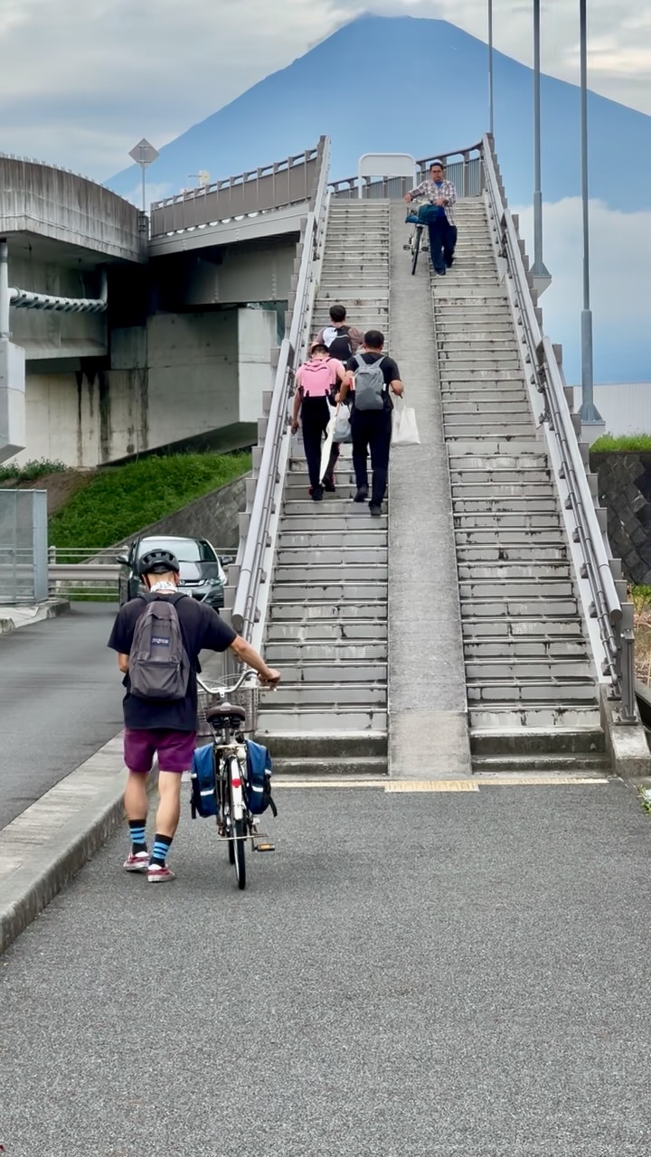
A popular spot among Instagrammers worldwide for its iconic staircase photo, which looks as if you’re ascending Mt. Fuji. The route follows a coastal path from the inn, passing through roads with minimal traffic.
富士山に登っていくような階段の写真が撮れることで、世界のインスタグラマーに人気のスポット。宿から海沿いのルートを通り、車が少ない道を走ります。
The total distance is approximately 17 km, with an estimated duration of 2.5 to 3 hours. Since the course is mostly flat, it is also suitable for pedal bikes.
全長約17kmで、所要時間は約2.5~3時間。ほとんど起伏がないため、ペダルバイクでも楽しめます。
https://www.google.com/maps/d/viewermid=1QLYmayrNZulreSUFmr9DBcOovQmpmQY&usp=sharing
Nodayama Park, Sea to Summit野田山緑地公園・海から山頂に向かって

This route takes you from Kambara to Nodayama Health Park, featuring a 700-meter ascent that can be easily tackled with an E-bike. The journey takes approximately 3 to 3.5 hours. Since there are few spots to buy food and drinks along the way, it’s recommended to bring your own supplies.
蒲原から野田山健康公園へ至るルートは、標高約700メートルの登りをEバイクで楽に登れます。所要時間は約3~3.5時間。途中の補給ポイントが少ないため、食べ物や水を持参しましょう。
The total distance is about 22 km, with steep descents requiring careful riding. A windbreaker is also advised for cold conditions. Nodayama Green Park is a campsite, so be sure to check in at the reception upon arrival. If the weather is clear, you can enjoy a spectacular view of Mt. Fuji from the summit.
全長約22kmで、急な下り坂があるため慎重な走行が必要です。寒さ対策にウィンドブレーカーの持参も推奨します。野田山緑地公園はキャンプ場なので、入る時には受付に一言声をかけよう。天気が良ければ富士山の絶景も楽しめます。
Satta Path, old avenue Tokaido Japan trads薩埵峠・旧東海道を感じる
This route follows the old Tokaido road, preserving the scenic charm of traditional Japan. Traveling from Kambara along the coastal roads, you’ll experience both the cultural heritage and natural beauty leading to Okitsu. Along the way, visit seaside temples and enjoy fresh seafood from the popular local deli, Yamaboshi Suisan.
旧東海道を辿る、古き日本の景色の残るルートです。蒲原から海沿いの通りと文化を巡って興津へ向かいます。道中に海の見えるお寺を巡り、地元で人気の『山干水産』のシーフードお惣菜を楽しみましょう。
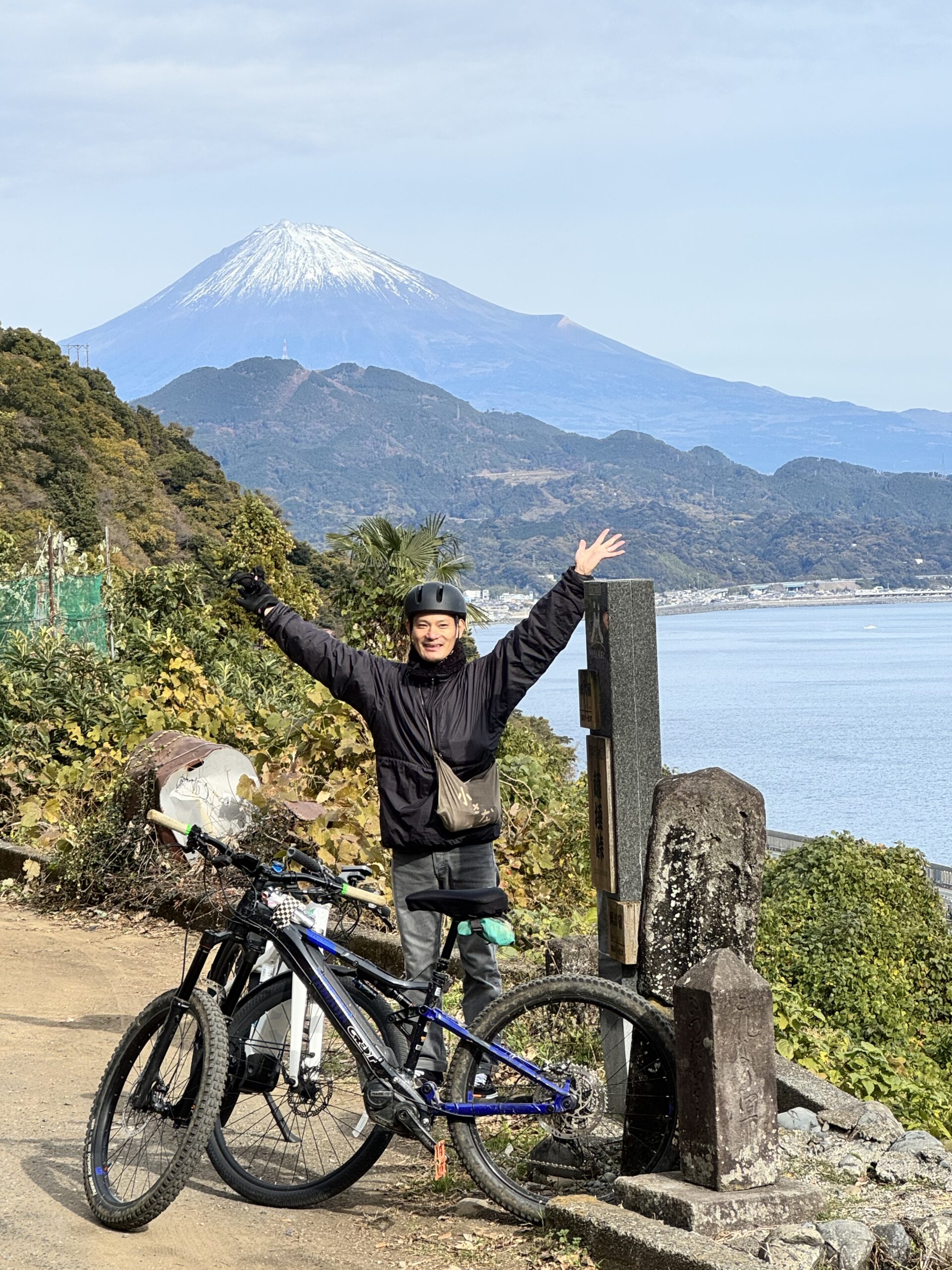
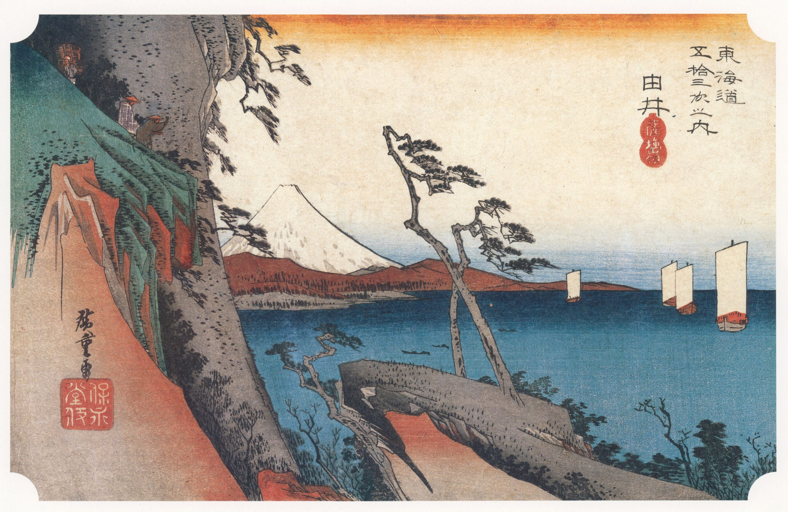
The highlight of this journey is the climb to Satta Pass. From the summit, you can take in a breathtaking view of Mt. Fuji— a scene famously depicted in Hiroshige’s ukiyo-e pictures.
目玉はぐいっと登った先にある薩埵峠。頂上から見る富士山は広重の浮世絵でもお馴染みです。
E-bike : 0m~2400m Kambara Coast to Mt. Fuji 5th Stationeバイク:蒲原海岸から富士山五合目へ
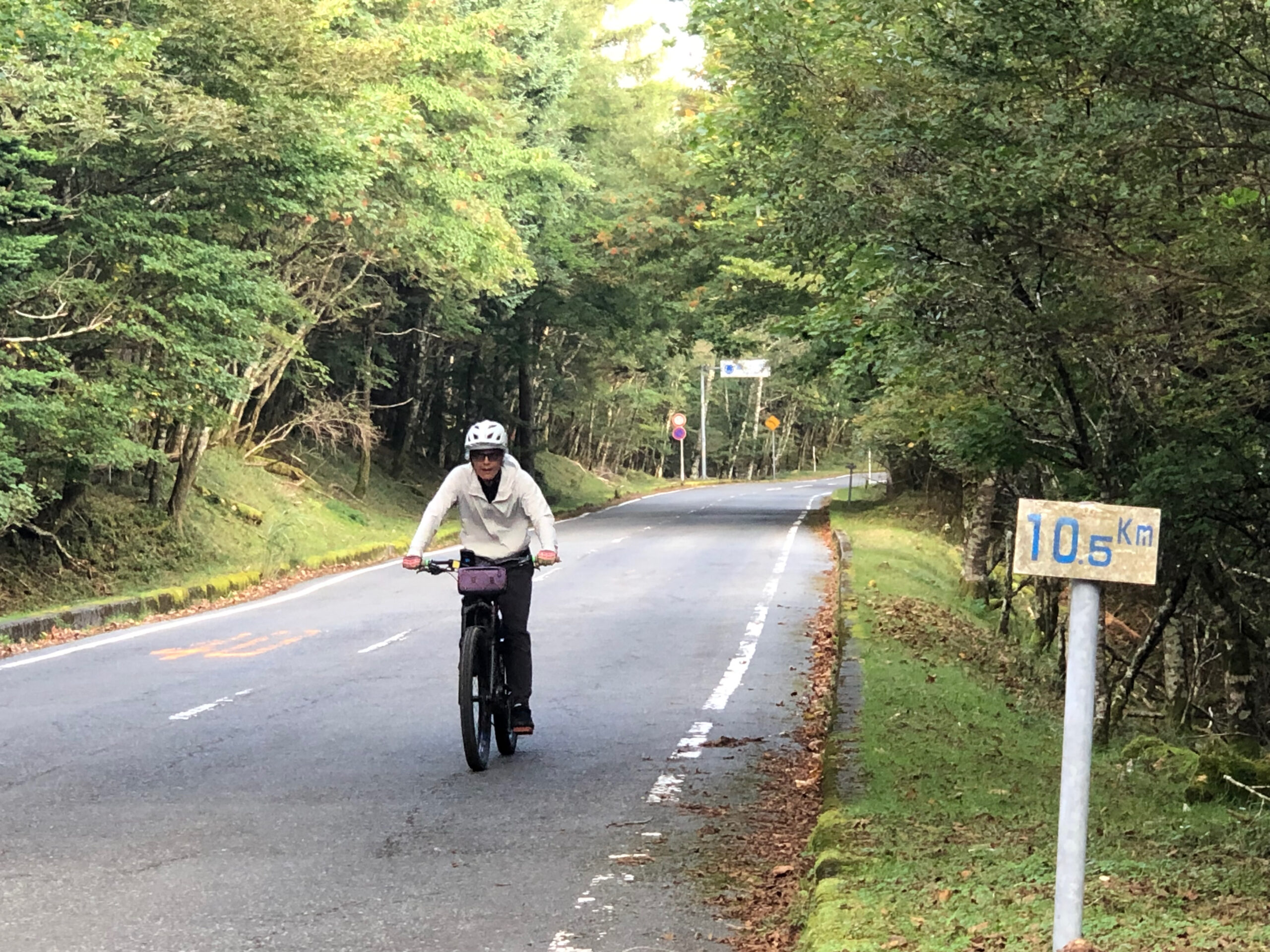
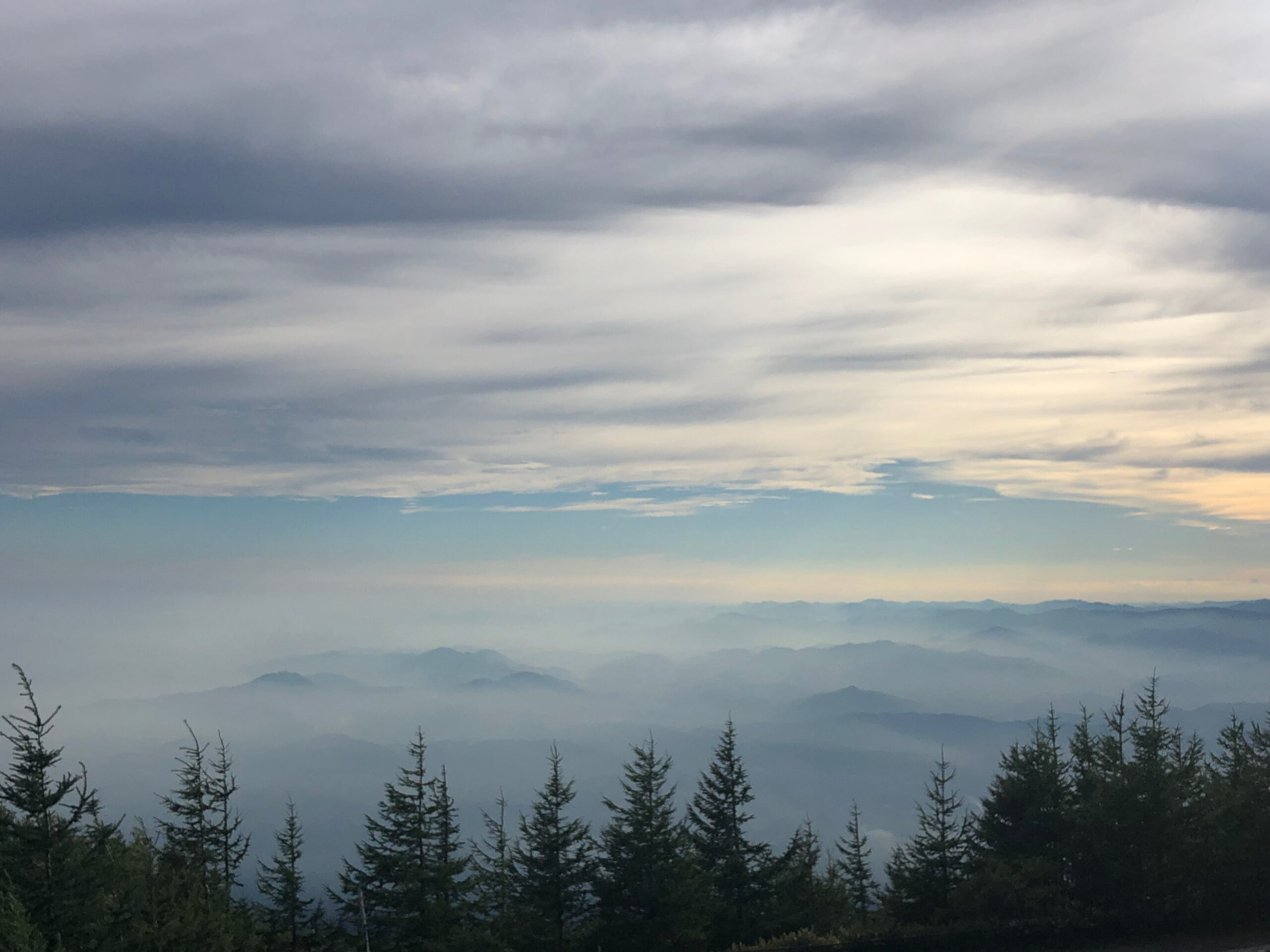
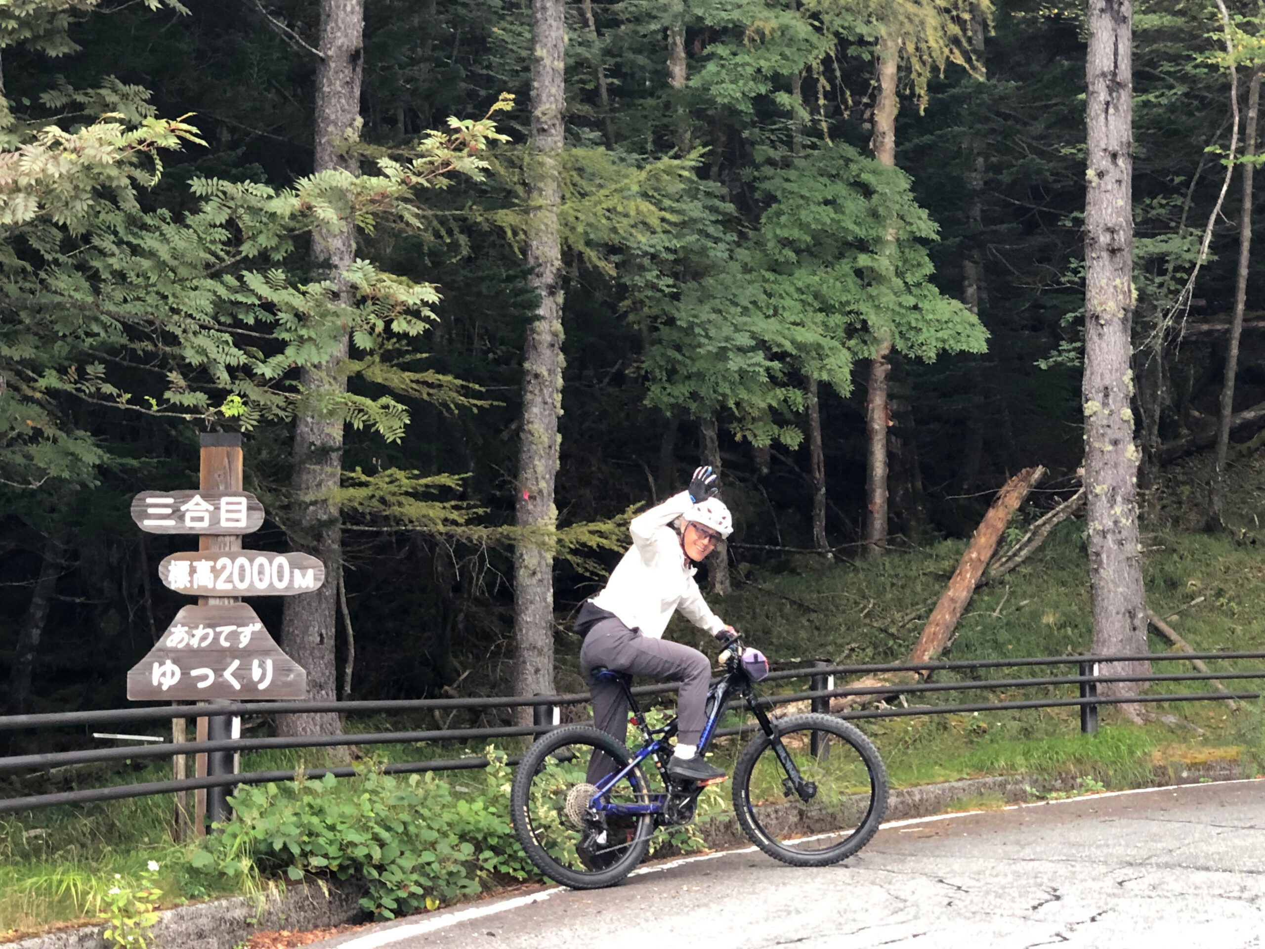
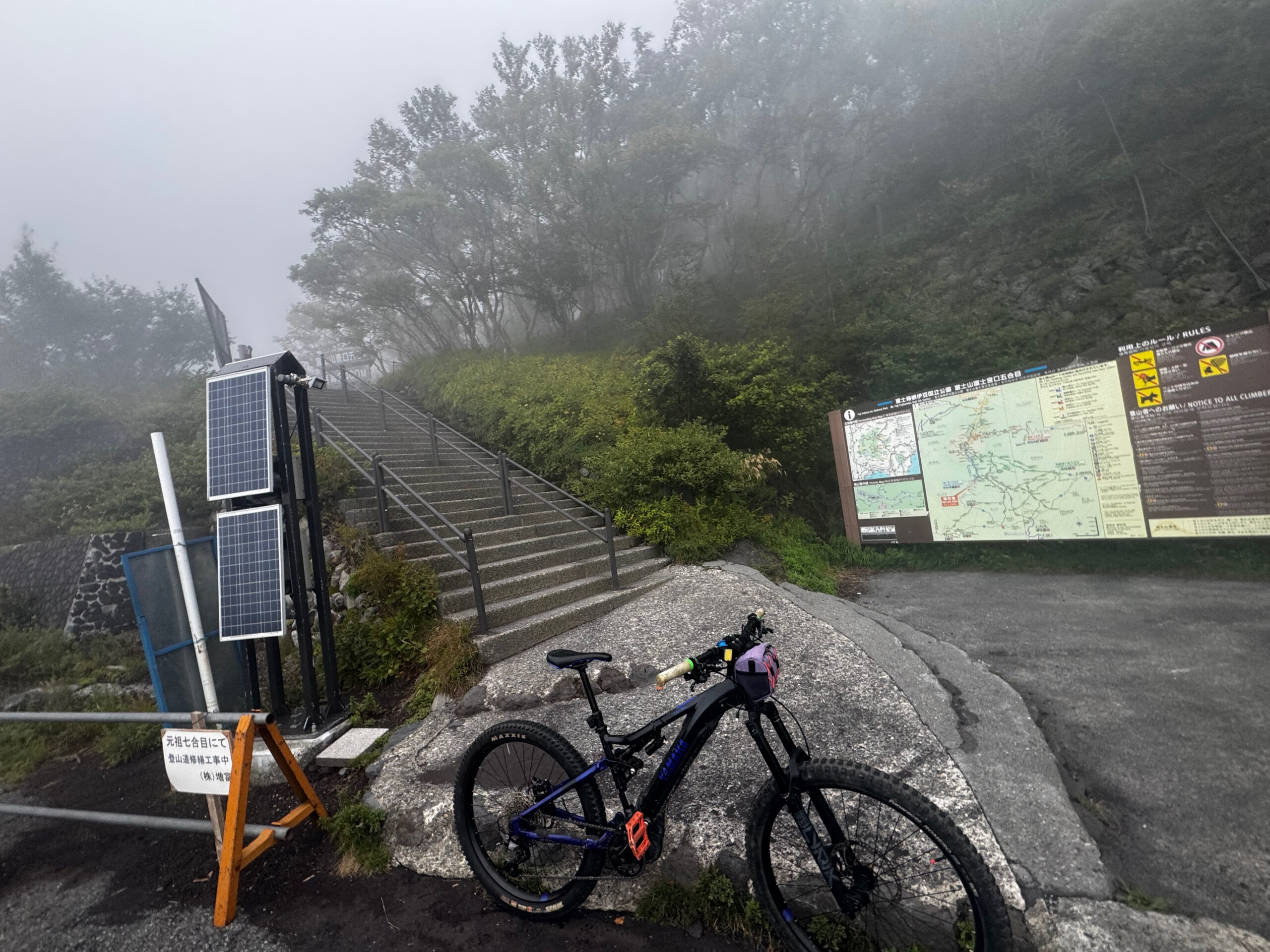
An e-bike ride from the Kambara coast at sea level to Mt. Fuji Fujinomiya 5th Station, climbing from 0 meters to roughly 2,400 meters above sea level. The route follows quiet roads as much as possible, leaving the ocean behind and gradually rising toward the slopes of Mt. Fuji. It includes battery charging stops, a rest stop at Mizugatsuka, and the final climb into the clouds toward Fujinomiya 5th Station.
海抜0mの蒲原の海岸から、標高約2400mの富士山・富士宮口五合目まで登るeバイクライドです。ルートはできるだけ交通量の少ない静かな道をつなぎ、海を背にして、少しずつ富士山の斜面へと高度を上げていきます。途中にはバッテリー充電のための休憩、水ヶ塚でのレストストップ、そして富士宮口五合目へ向かって雲の中へ入っていく劇的な登りが最後に待っています。