 Cycling maps shows cycling routes designed for a comfortable ride. Each route takes approximately 3 to 4 hours and is based on actual enjoyable rides. Embark on a pleasant cycling adventure that leads you to stunning landscapes and captivating spots.
自転車が快適に走れるおすすめルートの自転車マップです。各ルートの所要時間はおよそ3~4時間、実際に走った楽しいライドです。美しい景色や魅力的なスポットへと続く、心地よいサイクリングの冒険をどうぞ。
 ”Fujisan Yumeno Ohashi” Ride Map
『富士山・夢の大橋』自転車マップ
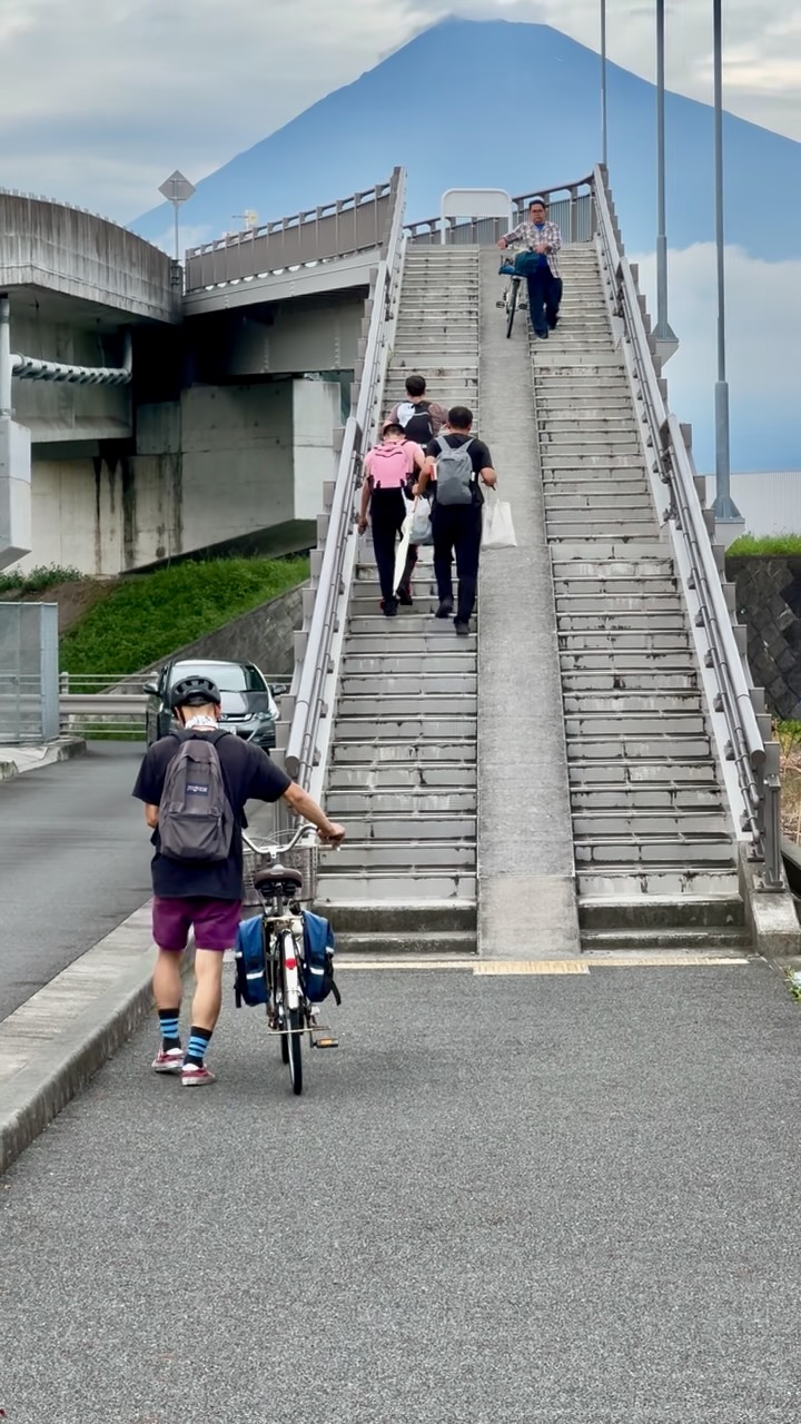
A popular spot among Instagrammers worldwide for its iconic staircase photo, which looks as if you’re ascending Mt. Fuji. The route follows a coastal path from the inn, passing through roads with minimal traffic.
富士山に登っていくような階段の写真が撮れることで、世界のインスタグラマーに人気のスポット。宿から海沿いのルートを通り、車が少ない道を走ります。
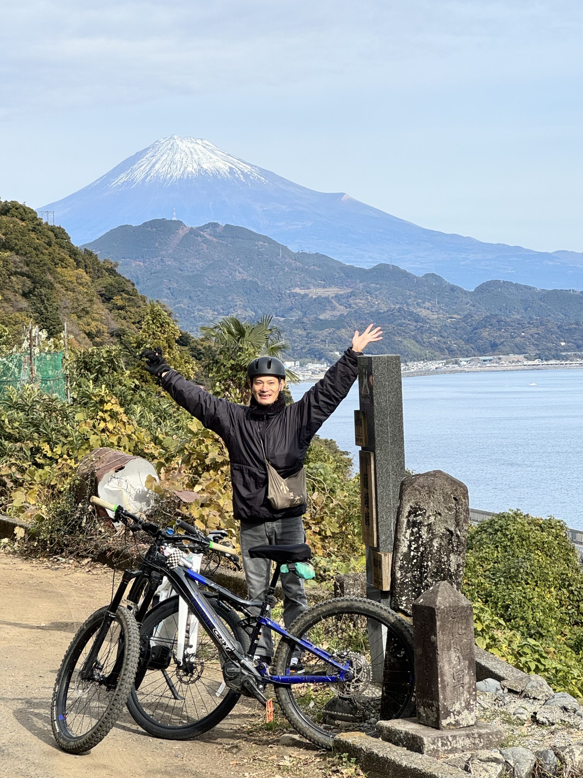
 Nodayama Park, Sea to Summit
野田山緑地公園・海から山頂に向かって
This route takes you from Kambara to Nodayama Health Park, featuring a 700-meter ascent that can be easily tackled with an E-bike. The journey takes approximately 3 to 3.5 hours.
蒲原から野田山健康公園へ至るルートは、標高約700メートルの登りをEバイクで楽に登れます。所要時間は約3~3.5時間。
 Satta Path, old avenue Tokaido Japan traditions
薩埵峠・旧東海道を感じる
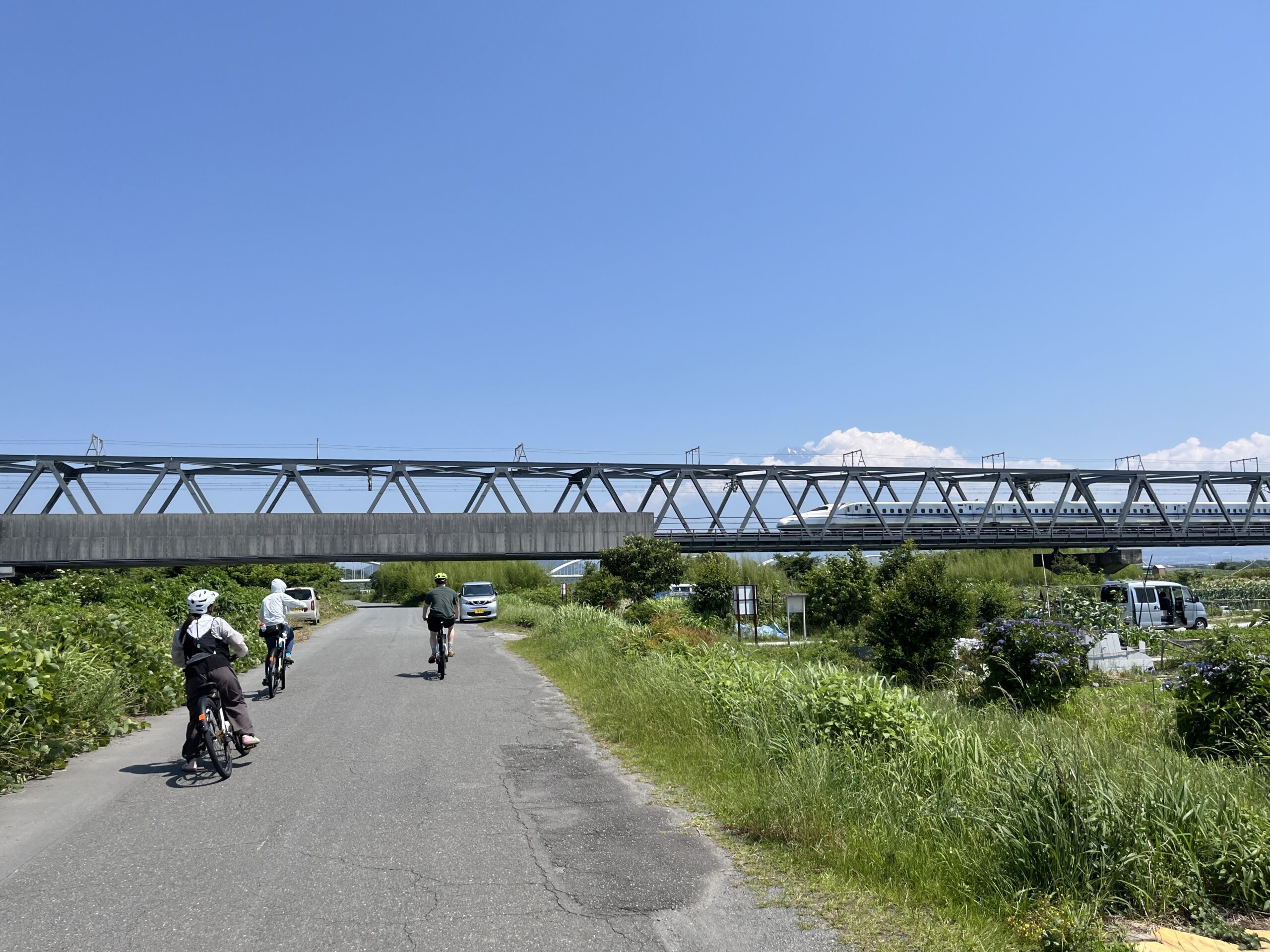
This route follows the old Tokaido road, preserving the scenic charm of traditional Japan. Traveling from Kambara along the coastal roads, you’ll experience both the cultural heritage and natural beauty leading to Okitsu.
旧東海道を辿る、古き日本の景色の残るルートです。蒲原から海沿いの通りと文化を巡って興津へ向かいます。
Click for >> Bike Rentals / レンタサイクル
Click for >> Guided Cycling ガイド付きサイクリング